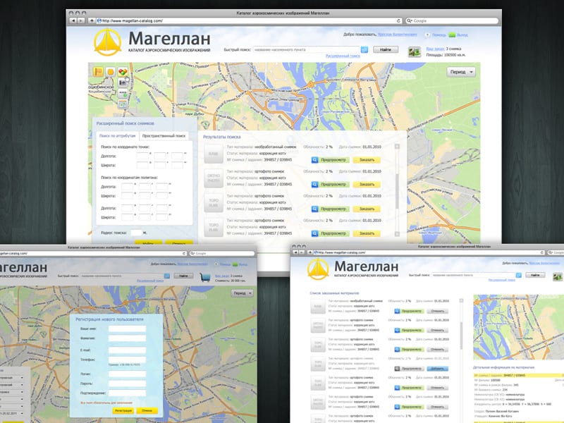
Online catalog of GIS data
An efficient system for managing and searching geospatial data, including images and vector maps, tailored for aerospace needs.

Product information
Magellan Ltd.
Aerospace agency internal system that provides mechanism to collect and search spatial data. Main features: online management of stored images, vector maps and other geospatial data in vendor’s database, tools for data search, processing customers’ orders, etc.
- C#
- JavaScript
- AngularJS
- ASP.NET MVC
- MS SQL
- Entity Framework
FAQs
Frequently Asked Questions
What is the purpose of the Aerospace Agency Catalog system?
The system is designed to collect, store, and manage geospatial data, including images and vector maps, for aerospace needs. It enables efficient data search and order processing within the agency’s database.
How does the system facilitate the management of spatial data?
The system offers a mechanism for online management of geospatial data, allowing users to easily access and update images, vector maps, and other spatial resources.
What benefits does this system bring to aerospace agencies?
The system improves data management efficiency, facilitates quick access to spatial data, and ensures accurate processing of customer orders, ultimately enhancing operational workflows.
Is the catalog system compatible with existing databases?
Absolutely. The system is designed for seamless integration with existing databases, ensuring that users can work within their established data environments without disruption.
Contact us!
Do you have an idea for a website, online business, or application, but need a team to turn that idea into reality?

